Siler Bald, one of North Carolina’s famous bald mountains, is accessible via two different routes on the Appalachian Trail. The easiest access, starting at Winding Stair Gap on Highway 64 east of Franklin, NC, is the longest trek at 4.6 miles one way to the summit. For a shorter walk, and my preferred method of accessing Siler Bald as a day hike, you can drive up Wayah Road to Wayah Crest trailhead. From this trailhead, it’s a 1.2 mile hike on the AT, then .2 miles to the summit via a side trail. This is the route this trail guide will be focusing on.
To find the trailhead:
There are a lot of places online to find directions to this trailhead, so I’m not going into specifics. Basically, head east on Highway 64 from Franklin for a couple miles (approx.) until you see the sign for Wayah Bald. You’ll turn right there, and then take an immediate left onto Wayah Road. Wayah Road winds up the mountain gradually at first and then ascends steeply via switchbacks to an altitude of 4,180ft at Wayah Gap. You’ll know you’ve reached Wayah Gap because there’s an Appalachian Trail crossing sign. You can park on the right at the bottom of USFS 69 and hop on the Appalachian Trail headed trail-south across the road. Alternatively, you can turn left onto a gravel side road just after passing USFS 69. Keep left on this gravel road for a short distance and you’ll end in a small parking area at Wayah Crest Picnic Area. From here, walk up through the picnic area and take the short (less than 1/10 mile) side trail at the back up to the Appalachian Trail. You’ll cross an old logging path and hop on the AT just on the other side of it. THIS website has a short write-up and driving directions.
The Hike
If you access the AT from Wayah Gap, you’ll start at 4,180ft (you start a few feet higher up if you access from Wayah Crest Trailhead) and ascend to 5,001ft in 1.3 miles. For the most part this is a gradual climb that ascends the mountain via gentle switchbacks.
A short distance in and you will cross a small footbridge. There’s a stream here that flows reliably most of the time. At about half a mile in you will come to a piped spring. This spring flows reliably unless you’re hiking in the middle of a drought and is a good place to fill up on water if needed.
Continue climbing… you’ll know you’re close to the end when you pass an old wooden sign designating “snowbird gap”. At 1.3 miles you will reach a grassed clearing. The Appalachian Trail continues straight here headed toward Winding Stair Gap (4.2 miles south). You can also access Siler Bald Shelter a short distance away, but it’s down a steep side trail. To summit Siler Bald, you’ll need to turn right and head steeply uphill for approximately .2 miles. There is a trail here, though in certain seasons it can be difficult to spot.
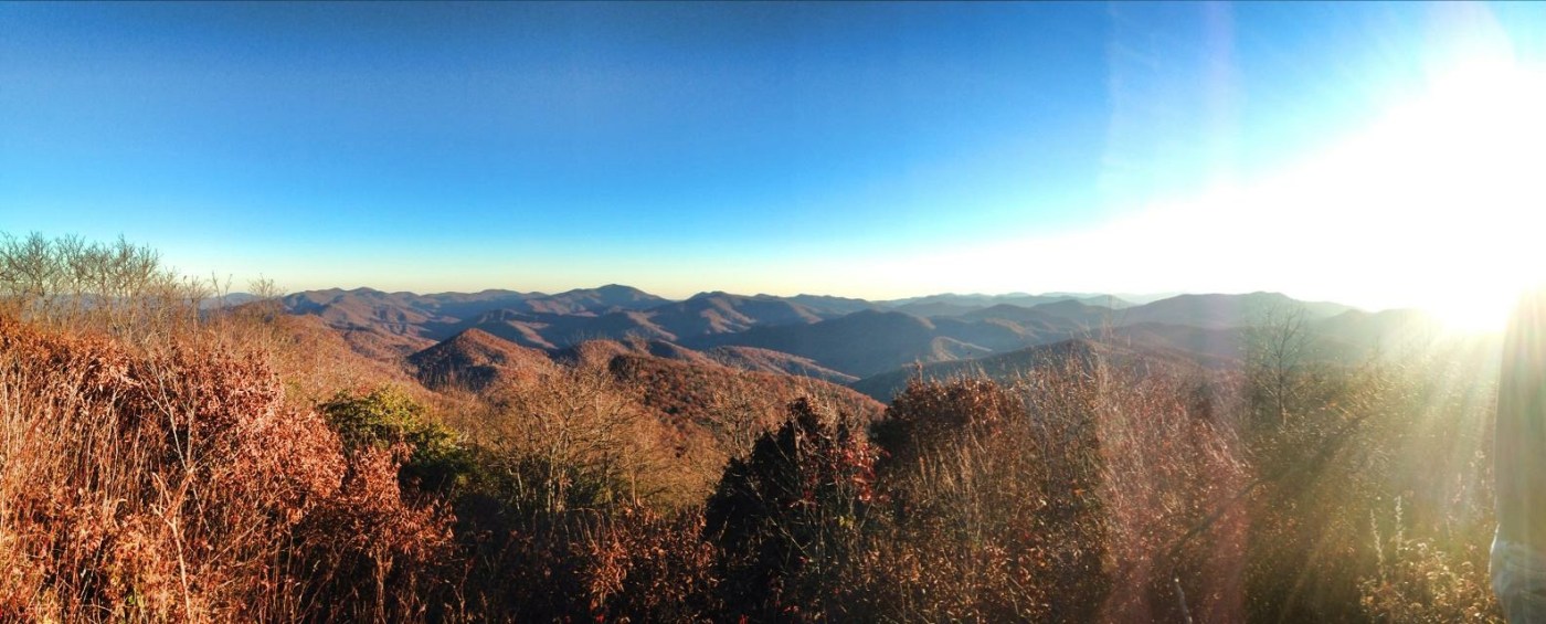
T he summit trail stays close to the southern treeline for about a tenth of a mile, passing a small camping area with a cowboy pit on the left before cutting across the grassy slope. This trail is steep and ascends over 200 feet in two-tenths of a mile to the 5,216ft summit of Siler Bald. Reaching the summit, you’ll find a cowboy pit and a plaque designating this as the summit. On clear days, the summit offers a stunning 360 degree view of the surrounding mountains. If you look closely, you can spot towers above nearby Wayah Bald, Winespring Bald, and Albert Mountain.
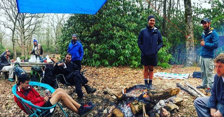
This is a great spot for a picnic or a night cowboy camping under the stars, but it can be dangerous in inclement weather. High-speed winds generally sweep over the bald, and you don’t want to be caught up there in a lightening storm. The elevation also means you should expect significantly cooler temperatures – up to a 15 degree difference from down in Franklin.
When finished, return down the summit trail until you hit the Appalachian Trail and take a left to descend back to the parking area the same way you came. Alternative, if you’ve arranged transportation, you can continue south on the Appalachian Trail for 4.2 miles to Winding Stair Gap on Highway 64.
My personal experiences
I’ve hiked Siler Bald several times. Most notably, I crossed this bald for the first time on an overnight hike in the Fall of 2014. Starting from Wayah Bald, I hiked south and camped .1 mile from the summit of Siler Bald. Seeing sunset and sunrise from the top of the bald was incredible.
In Spring 2016, I led a group of friends on a day hike up Siler Bald after an overnight snow-storm. This was most of their first times hiking in the snow (some of their first times hiking, ever!). The snow gave the forest a sparkly and magical feel. 
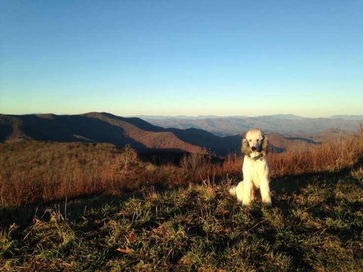
 In February 2017, my friend Amy and I left home at 4am to attempt a sunrise hike of Siler Bald, to meet one of our 52 Hike Challenge: Adventure Series goals. It was foggy, but we hoped the fog would lift by the time we reached the summit. Accompanied by our three standard poodles, we climbed to the top in a dark cloud.
I don’t think I’ve ever experienced such an all-encompassing darkness. The fog enveloped us and sucked up the light from our headlamps, causing visibility to be limited to a couple of feet. We actually missed the turn where the trail veers right across the footbridge early on in the hike. However, the Appalachian Trail is well-marked and we found ourselves at the summit shortly after, still socked in but able to see a noticeable increase in daylight. It wasn’t the spectacular sunrise we’d hoped for, but it was still a really cool experience.

In conclusion
Siler Bald is one of my favorite spots on the Appalachian Trail, right up there with Franconia Ridge in the White Mountains and McAfee Knob in Virginia. Many thru- and section-hikers skip this bald due to the steep side trail, but it is 150% worth that extra .2 miles.
I recommend this hike as one of my top hikes in the Franklin area. The half-hour drive to the trailhead is beautiful in itself, the road is paved and well-maintained, and the hike itself is moderate and suitable for all ages. Load up the kids or the dogs, pack a sandwich and a couple bottles of water, bring something to sit on, and enjoy the view from the top.


Leave a comment